Alberta Spatial Economic and Transportation (ASET) Model
The Alberta Spatial Economic and Transportation, or ‘ASET’, Model System is a computer-based simulation of the Alberta province-wide economic, land use and transportation systems and their interactions. It is designed for use in practical forecasting, planning and analysis work. It was developed in a multi-year program of activity, called the ASET Project, starting in 2016, sponsored by Alberta Transportation (AT), with HBA Specto and AT working together.
The ASET model was developed as a modelling system including a Spatial Economic Model “SEM” and a Transportation model “PATLAS”. The SEM includes an Activity Allocation (AA) Module and a Deterministic Space Development Module (SD). The model simulates outputs at three levels of geographies: 3000 TAZ system, 503 LUZ system and the parcel level.
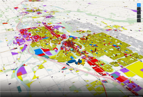
The parcel simulation for the SD module of the ASET involved over 3 million parcels. The model region (the entire Province of Alberta) consists of two metropolitan areas over 1 million people, along with over 300 cities, towns, rural areas and Indian reserves. The parcel simulation uses the tax assessment data as its foundation, with additional imputation of details from a variety of sources, including industry specific employment inventories, government and institution building data, skyscraper inventories, forest and water coverage layers, and park and Indian reserve lands from federal inventories. Additional parcels were added to the parcel database reflecting future plans published by local governments, including the phasing and staging of development. The parcel simulation results are visualized in rich animations using CityPhi, as well as through automated summary reporting. An online map generator is connected to a desktop GIS plugin through standard protocols, to enable easy visualization of model simulation results and policy impacts through time.
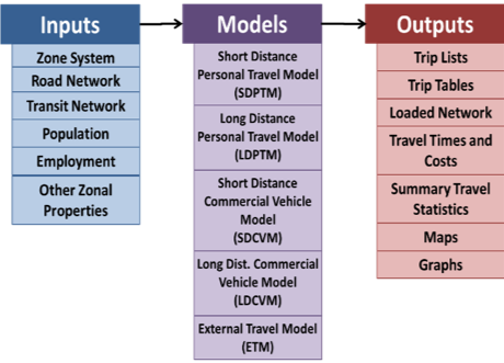
The PATLAS developed for the ASET model has five demand models, for combinations of short and long distance commercial and personal trips.
A web platform called “MrsGUI” was developed to start and control runs of the model on different server computers. MrsGUI controls and enables a strict version control of model inputs, to ensure scenario compatibility and reproducibility.
A detailed description of the Alberta Spatial Economic and Transport (ASET) Model can be found here, or using the button below.


